I had planned to end 2022 with a blog post looking ahead to the future and ways that CNY, and more specifically Syracuse, can encourage growth in sustainable way, I have had conversations over the years saying that Syracuse would be a great city of 250,000 people, with just small tweaks and changes to our built environment. Now, at the beginning of October 2022, these conversations take on a new urgency, with the announcement of Micron investing up to $100 billion just north of the City and bringing 9,000 high paying jobs, with up to 40,000 additional jobs in related industries. So to finish up my 2022 blog series, I plan to address this growth in three parts: Housing, Mobility, and Culture & Amenities.
I had initially intended to name this post “Growth in CNY: Transportation,” but after some thinking, I realized that the word “transportation” often is synonymous with cars. In contrast, I think we should really be thinking in terms of mobility in our communities. How can people get to where they need to go? Do they have options? Are you forced to use one mode over any other because of the built environment? This is how we must frame these conversations related to the Micron development and the growth of our region, or else we will continually be bogged down in conversations over cars and gridlock (which may or may not exist).
Mobility and housing must be intertwined if we ever hope to grow in a sustainable way. As I mentioned in the previous post, we should concentrate new housing developments in key locations that lend themselves to improved transit and active transportation options. Everything within this post builds off of where we build our housing and should work together to create a seamless network for all users.
The Community Grid
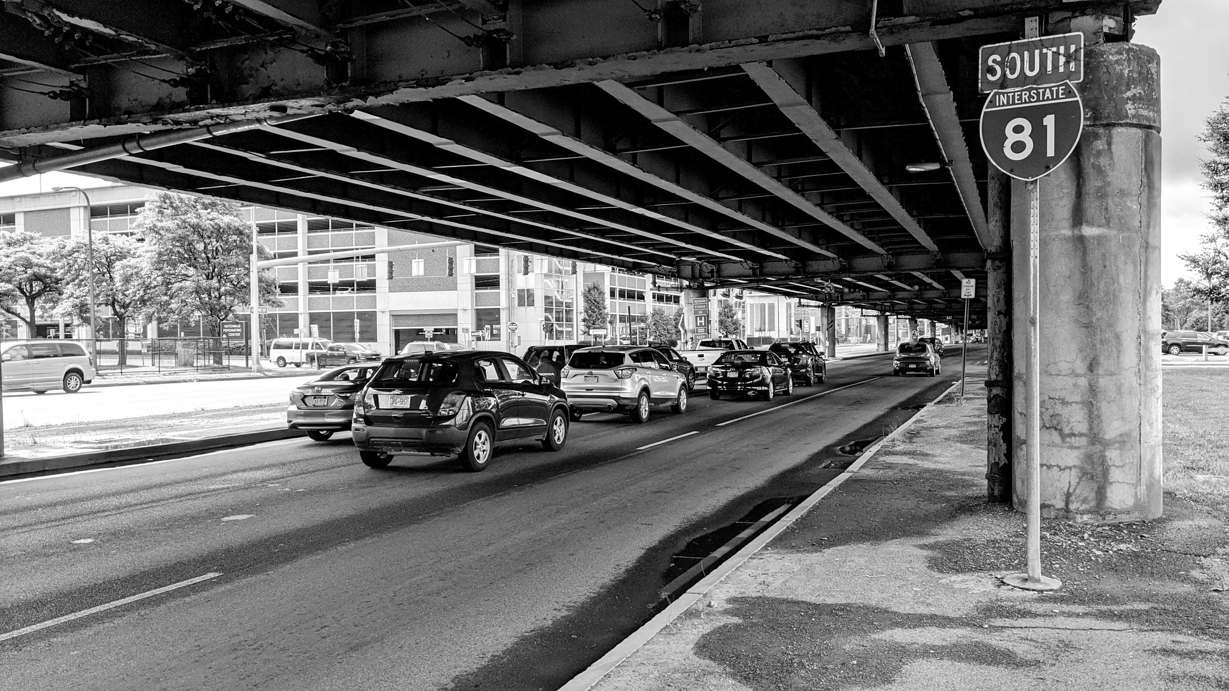
To state this clearly and succinctly: Syracuse, and CNY, need the community grid to replace the I-81 viaduct. We have spent well over a decade studying alternatives for a highway that should never have run along its current path to begin with. Micron selected the Syracuse area with the knowledge that portions of the highway network would be removed. Wider viaducts, tunnels, “sky bridges,” depressed highways have all been looked at in various capacities, but they fail to address the fundamental issue of highways and traffic - induced demand. As you make it easier to drive by adding more lanes, more people will choose to drive. This is one of the major drivers of suburban sprawl and leads to increased congestion as a result. The community grid can help solve this, even if I believe it doesn’t go far enough.
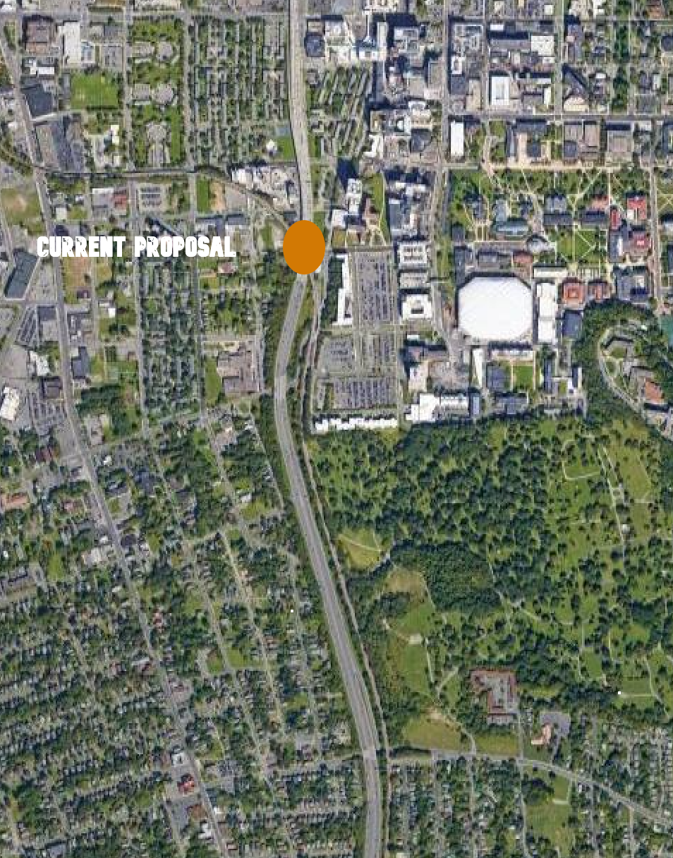
While the current plan does well at improving non-vehicle mobility within the Downtown core, the plan still maintains barriers north and south of Downtown. Unlike the unfortunate lawsuit currently holding up progress on the project, the answer is not to continue having a highway cutting through the city, but in fact requires the elimination of more of the highway. Over the past year, the plan has shortened the community grid portion of the project by several blocks, moving a planned roundabout north to avoid bringing all traffic to grade level next to an elementary school. While the issues raised about the placement of the roundabout are valid, plenty of roundabouts exist near schools throughout the world. But, while we’re looking to move the roundabout, I would argue instead to add more of them further south. Bring the highway down to street level and speeds 3,000 ft south of Dr. King elementary to Colvin St, adding in a roundabout, allowing vehicles to disperse along the street grid prior to reaching the school. At the same time maintain a roundabout near Dr. King and at the new proposed location at Van Buren St (see graphics below). This will continue to enforce slower speeds through the city while maintaining efficient through-put, something many of our suburban neighbors are concerned about. Single lane roundabouts have been proven to handle over 30,000 vehicles per day.
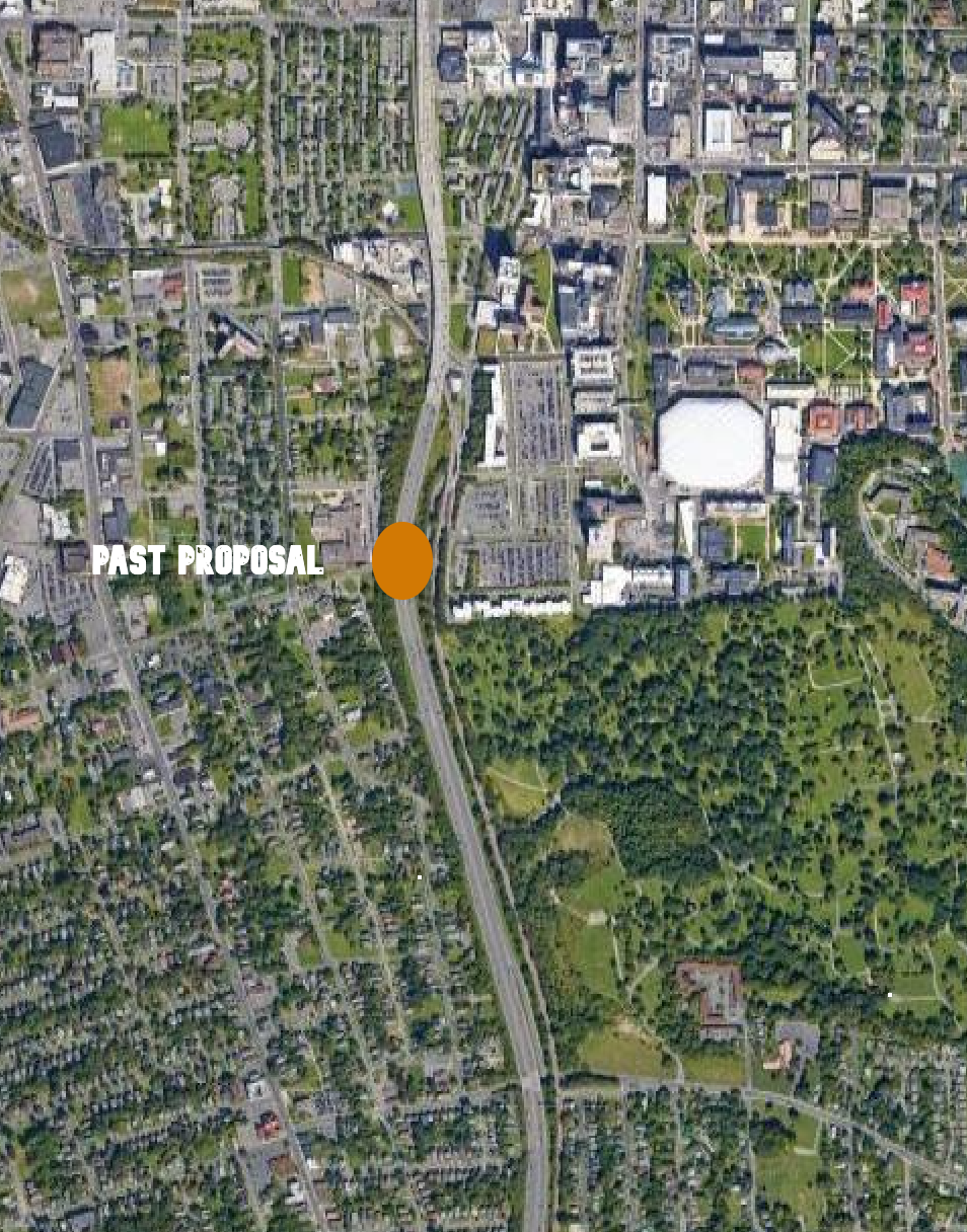
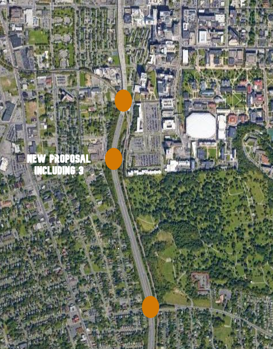
North of Downtown Syracuse will not only see the highway maintained, but in fact expanded by a lane in each direction. While many suburban leaders will say these lanes are needed, especially in light of the Micron development north of the city, a better option would be repurposing the lanes to prioritize public transit and other high occupancy vehicles. I will discuss these options in greater detail later in this article, but it should be noted these changes can be made without expanding the highway through the Northside.
One of the greatest benefits of this project is the land freed up within the city once the viaduct comes down. The increased residential development potential, which was discussed in the previous post, can bring more residents into our region’s urban center, allowing for a car-light or car-free lifestyle close to employment opportunities, active transportation options, and public transit hubs. Importantly, this neighborhood will be well served by the proposed bus rapid transit (BRT) network.
Bus Rapid Transit (BRT)
As I have mentioned many times before on this blog, in 2018 the SMTC released the SMART1 report identifying the preferred route for two bus rapid transit (BRT) lines that cross Syracuse in an X shape. The first line connects Eastwood’s James St corridor down to the Onondaga Community College (OCC) campus in the Town of Onondaga. The second line connects Destiny USA along the city’s waterfront south to the Syracuse University (SU) campus. These lines follow existing transit lines that already have enough ridership demand to warrant BRT treatment. These lines already are, and will continue to be, the backbone of the bus network within Syracuse.
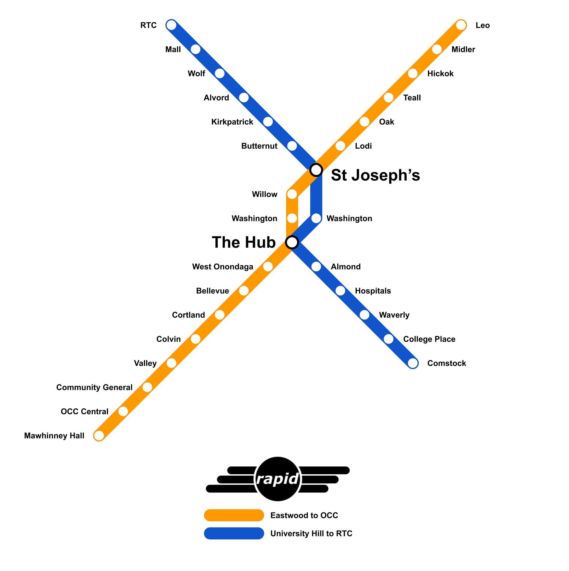
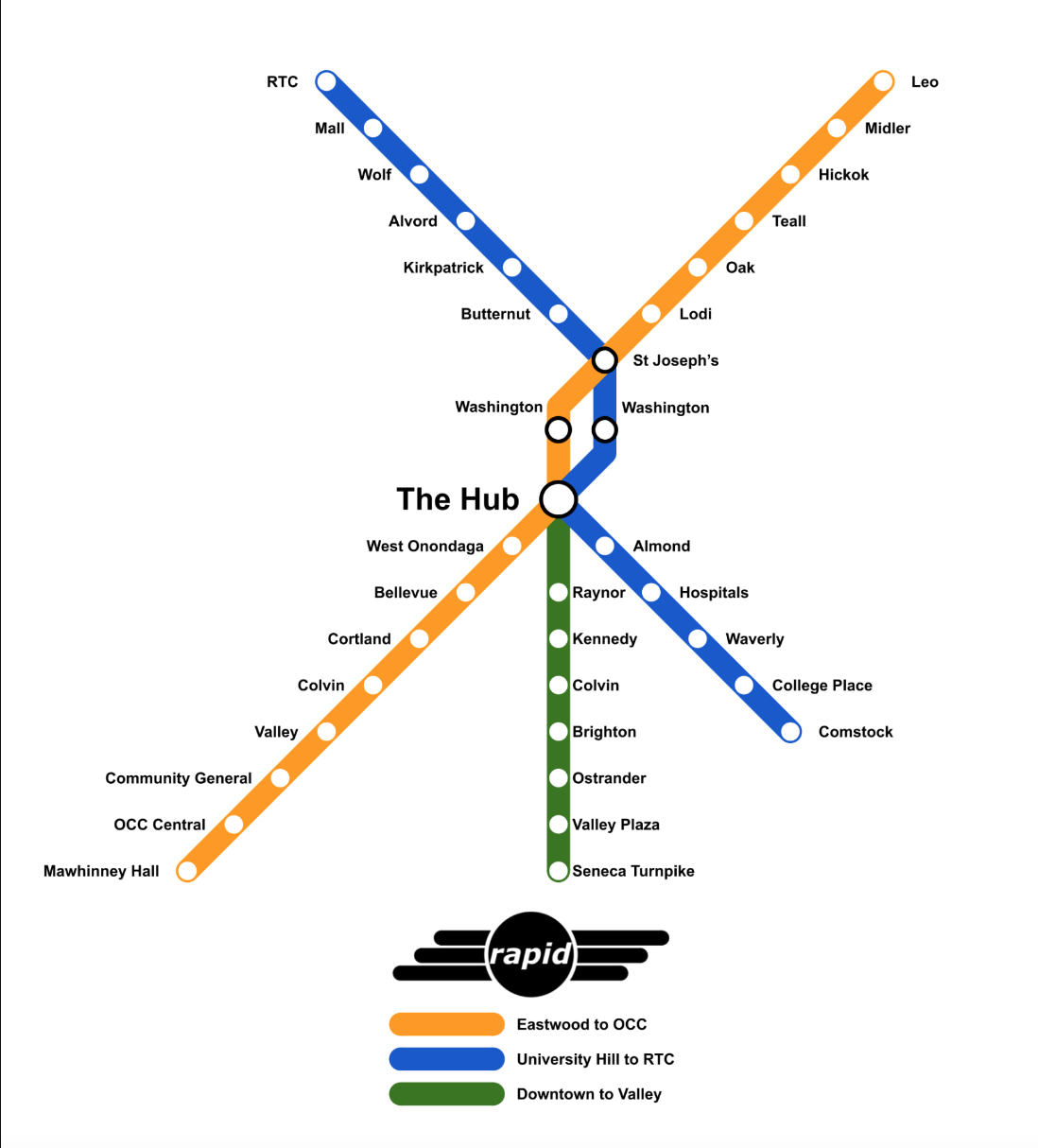
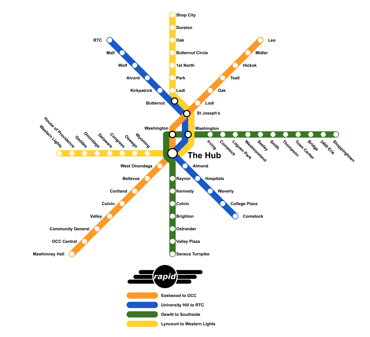
Fellow Syracuse blog, In The Salt City, has written countless pieces on BRT within the city, including identifying a more expansive network that I also believe should be further developed once the initial lines are up and running. Each of the maps above come directly from their blog and showcase how the network can expand moving forward. This urban network design is not, and should not be, affected by the Micron development.
While I recommend reading more about the lines and their destinations, let’s focus on how to make BRT work well within Syracuse, and that includes the location of stations, amenities at said stations, payment methods, and service.
It should be noted that the BRT system recommended within SMART1 is not full BRT, but instead improved service in mixed traffic. This means that buses will not have their own lane and will not be separated from traffic for most of their routes. This is similar to Albany, NY’s Bus Plus BRT system, which has recently expanded to three lines. While this makes sense for the city at the moment, we should look to set the stage for a more robust BRT network including bus only lanes. Again, we can learn from Albany.
While service may initially operate in mixed traffic, we must ensure stations are located in prime locations and given priority access to right-of-way. This includes siting stations as close to key destinations as possible, including grocery stores, pharmacies, entertainment venues, etc. Riders must see this as the most convenient option.
Similar to the SMART1 plan, CDTA, Albany’s public transit agency, utilizes targeted bus lanes around stations to prioritize boarding and alighting. Additionally, their stations employ the use of real time informational signage and free wi-fi.These amenities allow for riders to confidently know when their bus is arriving and be able to enjoy their personal devices as they wait. This has been shown to reduce how long riders feel they are waiting when compared to traditional bus stops. These are basic amenities that need to be included at all BRT stations to help promote the use of the service and improve rider experiences.
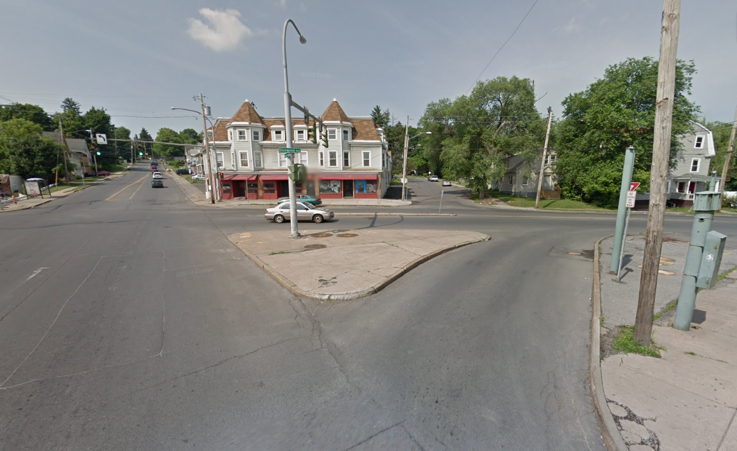
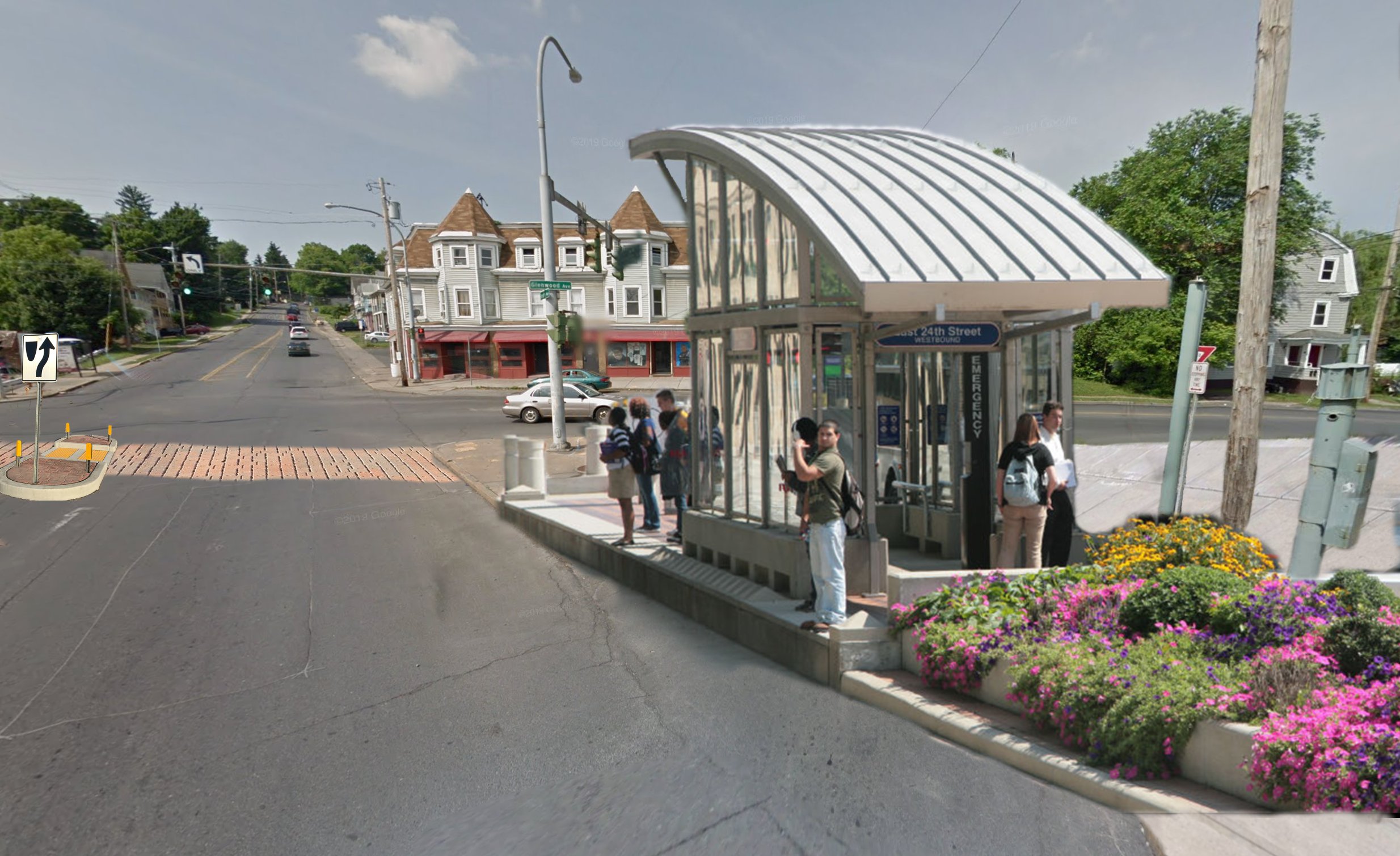
Another simple, but important, aspect of the station is that they’re all covered to protect riders from the elements. While the CDTA stations have larger coverings than traditional stops, they are not on the same level as true BRT stations found elsewhere around the world. Above are examples of stations in cities across the world. Many have raised platforms allowing riders to board the bus directly at an even level without the use of steps or waiting for the bus to “kneel,” or dip, to allow riders with mobility issues to board. These types of stations are also common with light rail and subway stations as they provide the most accessibility for all users. Stations of this quality should be the aim of the Syracuse BRT network. An example can be seen below.
Now looking at how we pay to ride, we need to embrace technology. Centro has been looking at using a tap payment system for riders, similar to OMNY in NYC, where riders can tap their phone as they enter the bus. While cash payments and physical cards must still be available for unbanked riders, adding a digital payment system will help increase casual ridership and simplify rides for long term customers. On the BRT system, this tap system should be installed prior to entering the station, allowing for immediate boarding without needing to wait for payments to be made on the bus.
Beyond the BRT system, creating easy to use weekly and monthly unlimited ride passes should be a priority. This includes creating a fare capping system so riders who cannot afford the upfront costs of unlimited passes can be ensured that they will not pay more than those passes cost over the same period of time.
Other Bus Connections
Moving away from BRT, other key bus connections must be implemented, including direct connections to the Micron development in Clay. As mentioned before, a bus only lane on I-81 as it runs north of Downtown would allow for an express bus service to serve the Micron development along with ancillary businesses that will undoubtedly pop up near the main plant. This service may start as a rush hour service, but it should be expanded to help better connect residents to the shops and services at either end of the line.
Looking at the development areas discussed in the previous post, a full build out at these sites may allow for high quality bus service to exist. Route 11 offers up one of the most promising bus routes. An increasingly dense and urbanized Mattydale will provide a key anchor point between the City and the northern suburbs, potentially allowing for a major transfer facility to be developed in one of the currently underutilized shopping plazas. As your travel north on Route 11, you pass through North Syracuse and the potential development sites SMTC reviewed in 2019, hitting dense population centers that can be focused around a high frequency bus service. At the Route 11 / Route 31 intersection, the service can head west to end at the Micron development.
At the other end of Route 31, a high frequency bus service could serve the Village of Baldwinsville and a redeveloped Great Northern Mall. Again, serving dense population centers and encouraging more walkable, bikeable communities connecting to the well developed bus stations and allowing for car free commutes to the Micron development from the suburbs.
The Bike Network
While public transportation has been the main focus up until this point, we cannot forget our bike network. Not only does a well designed bike network allow for increased mobility on its own, but it also allows for easy connections to public transportation, providing additional mobility methods without needing a personal vehicle. In 2012, the City of Syracuse released a bike plan which, if implemented fully, would provide a decent level of connectivity across the city. While the plan is a good place to start, many of the routes should be re-evaluated with modern standards in mind, emphasizing protected lanes wherever possible.
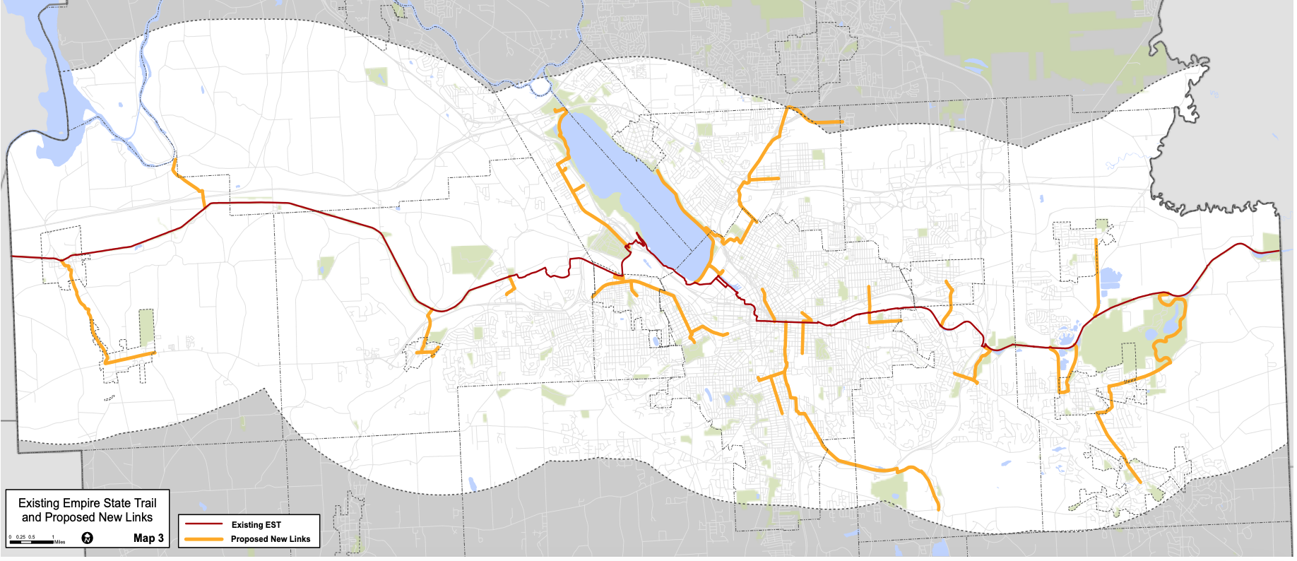
County wide map from the LEOP showcasing the different backbone routes.
At the end of 2020, the Empire State Trail (EST) was officially completed, providing a continuous bike route from Buffalo to Albany and NYC to the Canadian border. In 2022, Onondaga County, SMTC, and the CNY RPDB released the Empire State Trail Local Economic Opportunity Plan (LEOP) which looked to identify key routes to connect the EST into communities around Onondaga County. While these routes were limited to areas within four miles of the EST, they emphasize connections to population and commercial centers. They offer up a backbone for local communities to build off of, acting as collectors and arterials for bike riders.
Once a regional network is established, we need to make sure as many people as possible have access to a bike or other micro mobility option, like a scooter. One way to do this is by expanding the bike/scooter share network already in use in Syracuse into the suburbs. I have already written about some of my issues with the current system, including a desire for a membership option. I must acknowledge that the Veo Ride system is a dockless system, which my previous post did not note. At that, I believe we need to move away from a dockless system or at least prioritize the use of permanent hubs. By moving towards more of a hub oriented system, we can look to pair bike share with public transit, similar to a method Pittsburgh has been running with over the past few years, Move PGH.
Move PGH is Pittsburgh’s response to mobility as a service (MaaS). MaaS is the concept that all mobility methods should be integrated with one another, through apps and placement. Move PGH utilizes 50 mobility hubs which locate scooter and bike share docks at frequent transit stops. Additionally, car share only spaces are located nearby to offer additional mobility options. Move PGH has worked towards creating an app where users can book their entire trip at once, paying for their transit use, reserving a scooter/bike or even a car as needed. A similar system in Syracuse would require our scooter/bike share system to emphasize the use of docks to ensure transit riders have access upon their arrival.
But we shouldn’t forget individuals who own their own bikes and scooters. Something most cities in the United States struggle to do is provide secure bike parking. One company trying to change this is Oonee, out of NYC*. Over the past year they have rolled out secure bike parking pods across Jersey City and parts of NYC, using advertising sold on the pod exteriors to keep the use of the pods free. Syracuse and Onondaga County should be looking for similar solutions to roll out near transit stops and destinations to encourage the use of bikes and scooters around the region.
Bikes are some of the cheapest and most accessible forms of travel out there, with models built for different ages and abilities. The fast growing market of e-bikes is something that is welcome news for a hilly city like Syracuse. Many riders struggle up the hills that many of our neighborhoods sit on, making biking a less attractive option to get to and from work. Who wants to show up to work covered in sweat? One of the issues with e-bikes is the upfront cost of many of the higher quality bikes. While there are some low-cost models, they tend to have less safe batteries and limited weight/distances. One way to change this dynamic is by implementing a rebate system, similar to ones existing for electric vehicles. Denver has been a pioneer in this, offering up to $1,700 back for e-bikes, including cargo bikes. New York State should be looking to do the same, but offer that rebate to the bike seller, so the customer can immediately get that discount, making the upfront cost more affordable. This would be a game changer in terms of access for all users.
OnTrack 2.0?
As many people know, I loved riding OnTrack as a kid and have even advocated for its return to service, albeit in a much more functional capacity. While I still believe the Syracuse region could benefit from using trains for transit purposes, I think our main efforts should be towards improving our bus network. Should BRT and an improved bus network yield results, we should not be afraid to revisit OnTrack’s original vision of connecting the airport - baseball park - Destiny USA - Downtown - SU, and eventually expanding out towards the Micron development.
Parking Maximums
With all of the mobility opportunities presented so far, one of the most important policies we need to implement to encourage both the expansion of these options and the housing density needed to make them work well is eliminating parking minimums and implementing parking maximums.
For those that do not know, our current zoning laws, which vary by municipality, require all property owners to provide a minimum amount of parking space for their property. Each type of use requires a different amount of parking. While this might make sense on its face, the truth is those requirements are not based on anything. They are made up numbers, best guesses, whatever felt right to the authors of that specific zoning code.
By eliminating parking minimums, you allow businesses to decide how much parking works for their business. This lowers the cost of entry for many businesses who can’t afford the large swaths of land parking requires. It also makes each building more adaptable since a different business type can take over without needing to expand their parking facilities. And this isn’t a new idea. In fact, it has picked up steam in recent years, with even Anchorage, Alaska abolishing parking minimums in November.
Parking maximums, on the other hand, help prevent excessively large parking lots from developing. This allows for denser development to occur at lower costs, increasing walkability and rollability while also encouraging the use of nearby transit options.
Mobility requires each of these pieces to work together. While many people will still use their personal vehicles to get around, we cannot grow in a sustainable way if nearly every trip requires one. Creating an environment where a family can get by with one car, or even no car, should be our goal as our region finally experiences growth.
*Full disclosure, I have (minimally) invested in Oonee as I believe it is a company addressing a key issue in our urban mobility network.

